|
- The market town of Bourne, Lincolnshire, England - |
The fens
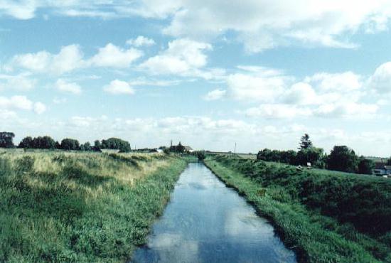
The River Glen where it crosses the South Fen Road near Bourne
THE FENS ARE a vast, extremely flat plain bordering the Wash, a large area of mainly reclaimed land lying between Cambridge and Lincoln which today comprises some of the richest farmland in Britain, easily identified by its black soil. The last 2,000 years of its history has influenced the development of the landscape, the architecture of its abbeys, parish churches and country houses, villages and towns, natural history, industry and of course agriculture.
The Great Level, as it was once known, occupies an area of about 1,306 square miles, or 700,000 acres, in five counties of eastern England. The extreme length of fenland, from Lincoln in the north to Quy, Cambridgeshire, in the south, is 73 miles while its breadth from Brandon, Suffolk, in the east to Peterborough in the west, is approximately 36 miles. In earlier times, the place had the reputation as "a deep and horrible fen, a strange land of fetid pools and flowing rivers, and a terrain grim enough to daunt all but the most intrepid settler". The 8th century chronicler, Felix of Crowland, described it thus: "A trackless waste of immense marshes and foul running streams." Because of its low-lying situation and the excessive damp of the region, it was "oft-times clouded with moist and dark vapours" and rumours widely prevalent at the time suggested that it was also "the haunt of devils".Farming prosperity around Bourne is a direct result of the drainage of the fens, a continuous feat of engineering over the centuries that have turned this area into the country's richest agricultural land. Proposals to drain this area of the South Holland fen were put forward in the 17th century following the passing of the General Draining Act in 1600 and it was the Earl of Lindsey, the Lord High Chamberlain of England, who was responsible for cutting a 24-mile channel from the River Glen near Bourne to Boston before enclosing the resulting land and building farms on it.
Huge land areas were controlled by windmills to drive water paddles to push water from the dykes into the drainage channels in time of pending flood but these were superseded by steam engines during the 19th century and the operation is now carried out by turbo-electric equipment and the pumping station at Dowsby Fen, pictured above, was brought into operation in 1964.
It has taken more than 300 years to drain the fens and to provide a really effective protection against flooding in all but the most extreme of weather patterns. Today, fenland is considered to be among the best drained areas of Britain and Anglian Water continues with a programme of constant repair and renewal to ensure that the first class arable land it serves can fulfil its vital role of food production on which thousands of people depend for their livelihood.
An illustrated history of the fens, its people and agriculture, can be found on
the CD-ROM A Portrait of Bourne