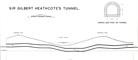
Tunnel Bank is named after a culvert or relief channel built under the River Glen near Bourne during the 17th century by local land owner John Heathcote as part of a wider scheme to drain the fens in the locality. It is known as Heathcote's Tunnel but is often referred to as Sir Gilbert Heathcote's Tunnel after the first baronet and although a descendant, he was not born when the tunnel was built. It is also sometimes known as Lord Aveland's Tunnel after another descendant who became the first East of Ancaster. John Heathcote was an adventurer, the name given to those gentlemen, usually lords, noblemen and wealthy landowners, who invested their money in a venture to drain and reclaim the fens which were at that time vast wastes of water, reed and swamp and were recompensed by the award of large stretches of fenland. He was the original owner of the lands known as Bourne and Thurlby Fen Pastures and he embanked and kept them drained at his own expense but was prevented from passing the waters from them into the River Glen and so he constructed a tunnel under the river to convey them into the Counter Drain, also known as the Slaker Drain. The exact date of construction is not known but the tunnel is marked on a map drawn up by William Dugdale for his survey The History of Imbanking and Draining of Divers Fens and Marshes (1652) when it was called Thurlby Tunnel.
A petition by local inhabitants in Elizabeth I's reign had complained of
the poor condition of the surrounding land owing to the deteriorating
state of the banks along the rivers Welland and Glen and after various
attempts at drainage in the early 17th century, a Court of Sewers decree
was confirmed in 1632, giving the Earl of Bedford and others a concession
for draining Deeping Fen, Crowland and Bourne South Fen.
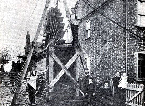
This fen lies on the west side of the River Glen and is bounded on the north by Bourne Eau, on the south by Bourne and Thurlby Pastures and on the west by the Car Dyke. It contains 850 acres and was first reclaimed by Thomas Lovell for the Adventurers of Deeping Fen and drained by the culvert under the Glen, which was maintained by the successors of the then owner, John Heathcote. This land was exempted from taxation to Deeping Fen by the Act of 1738. By an Act passed in the reign of George III, a clause was inserted to the effect that if the Deeping Fen Trust lowered the bed of the Glen then they should first lower the culvert which carried the water from Bourne South Fen and Thurlby Fen Pastures, and the right to drain thereby was confirmed. The original method of draining the South Fen remains. Steam engines to drive wheels were installed in 1871 and 1912 but it was not until 1948 that the system achieved its present efficiency with the building of the Bourne South Fen pumping station equipped with two high powered pumps although still using the Heathcote Tunnel to discharge water into the Counter Drain. Then between 1948 and 1976, a new electric pumping station installed at Tongue End revolutionised the drainage of the Bourne South Fen and Thurlby Fen and nearly all of the main drains within the district were deepened and widened to conform with the much lower pumping levels now required. Fishing rights along the Bourne Eau were
in past centuries under the jurisdiction of the Manor of Bourne Abbots and
are frequently mentioned in old documents. In 1753, for instance, the
fisheries in the locality, including both the rivers Eau and the Glen, are
defined in the will of Edward Presgrave as "the water from St Peter's Pool
to Eastcoate to the Cross of Goodroom Coate and the water of Eastcoate or
Glen to the Great Stone on the bank at the south east end of the South Fen
of Bourne" and this stone is believed to have been part of the land works
associated with the tunnel.
See also The draining of Bourne South Fen The River Glen The Adventurers The Heathcote family
Go to: Main Index Villages Index
|
||||||||||||


