|
The River Glen
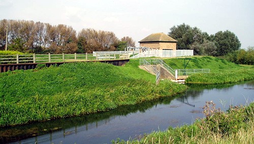
The River Glen
is a river in South Lincolnshire with a short but important
stretch passing through the South Fen at Bourne. The pumping station at
Tongue End (pictured above) which marks the head of navigation, is also
the point at which it joins the Bourne Eau.
The Glen rises at Boothby Pagnell and passes near Corby Glen, Little
Bytham and Greatford. It has various other names, notably the Brunne
River, Catebridge Water and Brunne Ee, the usual name being derived from
the British word gyn or glean meaning a valley. It enters the fen country
at Kate's Bridge, near Thurlby, and flows between the high banks
separating the Deeping and Bourne fens and thence through Pinchbeck to
join the River Welland at Surfleet Reservoir after a course of 15½ miles.
The river has two sources, both in the low ridge of Jurassic rocks in the
west of the county. Its upper reaches go under the names of East and West
Glen but sometimes the East Glen is called the Eden, passing through the
parish of Edenham. The Glen has been embanked and partially straightened
in the fens and is navigable for its last 12 miles to its junction with
Bourne Eau at Tongue End, via Pinchbeck and Surfleet to the tidal entrance
sluice on the River Welland which is navigable only when the tidal level
is the same as the river level.
While the river is navigable to Tongue End, the upper reaches above
Pinchbeck Bars are only suitable for smaller boats, as there are no
locations where it is possible to turn a boat which is over 30 feet long.
However, the 8.9 mile section of the river from its source to Guthram Gowt
forms part of the proposed Fens Waterways Link which will ultimately link
the River Witham to the River Nene, via the South Forty Foot Drain, the
River Glen, the River Welland and some upgraded drains near Peterborough.
In 1781, the rivers became so choked with mud that navigations was almost
lost but an Act of Parliament empowered trustees to carry out the work and
maintain the waterways thereafter although navigation ceased to be of any
importance after the opening of the railways in the mid-19th century and
by 1866, all navigation had ceased.
In past times, the Glen provided a direct navigable link for Bourne with
boats regularly plying their trade to and from the wharves along Eastgate
bringing in coal and iron wares and returning with corn and skins. But the
river has always been one of the most treacherous in the fen country and
in 1882 it was reported that it had breached its banks 14 times between
1821 and 1882, eight times in the south bank and six in the north bank and
there were further breaches in 1912 and 1947.
|
 |
|
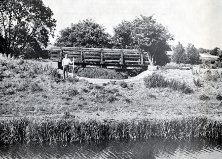
The overflow weir on the north bank of the
Bourne Eau photographed in 1976. |
The cause of this vulnerability is undoubtedly the construction of the
banks which consist mainly of layers of peat and soft clay, very steep in
construction, and some 15 feet or more above the level of the fens on
either side. W D Miles, engineer to the Welland and Deepings Internal
Drainage Board, wrote in 1976 that although the Greatford Cut has given
some relief, the factor safety against failure in full flood conditions
was still too small for comfort and constant attention and maintenance of
the highest order remained vital. He added:
Remember that a river embankment is similar to
a chain, the strength of which is governed by its weakest link. To those
responsible for its maintenance and safety today, persons who probably do
not remember the great floods of 1928, 1937 or even 1947, take heed of the
advice of a fenman and drainage engineer who has seen them all. Never turn
your back on the River Glen.
|
PHOTO ALBUM |
 |
|
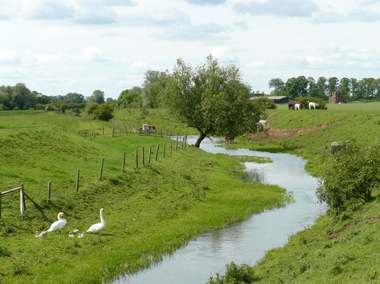
A pair of mute swans that have been resident
along the river near Kate's Bridge, south of Bourne, for a number of
years hatched six cygnets in 2012. |
 |
|
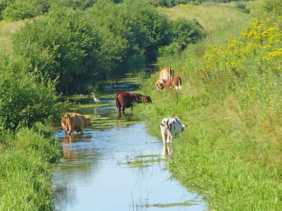
The River Glen at Thurlby Fen nature reserve is
quite shallow in places with herons competing for space with the
cattle and there is also a wonderful display of yellow ragwort all
along the banks to Kate's Bridge. |
|
 |
|
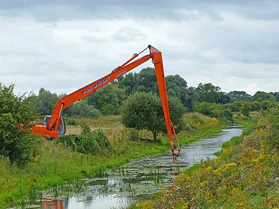
A prolific growth of weeds and sometimes green
algae frequently chokes the River Glen during hot summer months and
in August 2013 a dredger from the Environment Agency was used to
clear a stretch of the waterway from close to Baston Fen to Kate's
Bridge. |
|
THE RIVER GLEN IN PAST TIMES |
|
 |
|
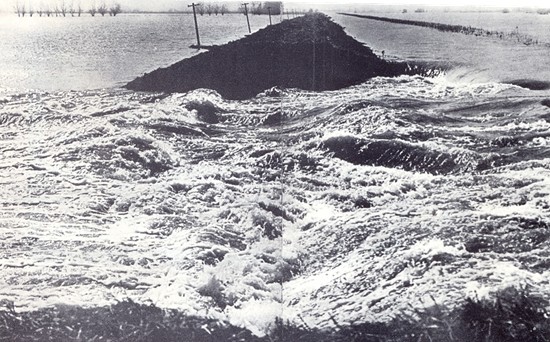
One of the biggest disasters in recent times
was the Great Flood of 1910 when the River Glen burst its banks
(above) while there have been several other similar occurrences as can be seen
from the undated picture below. |
|
 |
See also
Heathcote's tunnel
The draining of the South Fen
The Great Flood of 1910
Walking the River Glen

Go to:
Main Index Villages
Index
|


