|
|
|
|
About this town
|
|
|
|
|
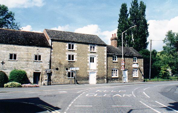
BOURNE is an historic market town looking eastward to the flat and fertile fens and westward to the delightful wooded uplands and it has a remarkable place in history. The Romans built a road known as King Street through here on its way to Sleaford and the Car Dyke, one of the greatest construction feats carried out in Britain by the engineers of the mighty Roman Empire, to carry food and supplies to their advancing armies. The town began its existence as a cluster of dwellings on the Car Dyke and subsequently became a Roman station, a Saxon stronghold and the site of a Norman abbey and castle, no mean achievement in the long pageant of British history.
Archaeological evidence of Roman occupation in Bourne has been discovered
in past years, one of which bears witness to religious activity. A
small bronze statue of a horse was found here and is now in the British
Museum. This is very similar to statuettes found close to the site of
shrines excavated at Brigstock in Northamptonshire. One of the Brigstock
statuettes was found together with its rider and there is a depression on
the back of the example from Bourne which suggests that it too originally
had a rider. Such statuettes might have adorned the tops of ritual staffs
used in religious ceremonies and a similar bronze horse was found in
Coventina's Well at Carrawburgh in Northumberland, outside one of the
forts on Hadrian's Wall, along with much other religious material,
although at this stage in our knowledge, it is not possible to suggest any
particular deity whose worship demanded the use of these ritual staffs.
This area includes the Aveland, Ness and parts of the Beltisloe wapentakes recorded in the Domesday Book, the great land survey of 1086 ordered by William the Conqueror in order to assess land tax and other dues, ascertain the value of the crown lands and enable the king to estimate the power of his vassal barons. The name Domesday is derived from the belief that its judgement was as final as that of doomsday. Wapentake is a Danish word equivalent to the word hundred that is used in other parts of the country to denote a subdivision of the county composed of groups of townships for the purpose of taxation. The name Kesteven is said to be composed of two elements, one the word for a wood and the second indicating a meeting in the sense of a district with a common meeting place. These elements are said to be respectively of British and Scandinavian origin. It was not the name of an early kingdom but was part of Middle Anglia and its separate identity may well have come with the creation of the English shires, in existence by the early part of the 11th century. The forest of Kesteven, as described in 1230, covered an area with boundaries running from Swaton along the Car Dyke to Market Deeping, then on to Spalding and to Bicker and back to Swaton and the woodland at Bourne, known today as Kesteven Forest, is most likely a surviving part of this forest. |
|
Here are some of the interesting features of the town. |
|||||
|
|||||
|
|
St Peter's Pool is fed by seven springs gushing out millions of gallons each day into the Bourne Eau. The ceaseless supply of water is undoubtedly the reason why early settlers made their home here and in later centuries, water played an important part in the development of the town. |
||||
|
One of the great engineering feats from the Roman occupation of Britain 2,000 years ago is the Car Dyke, a 75-mile long waterway built to carry supplies for the advancing armies and much of its length can be found in Lincolnshire and here it can be seen at Dowsby Fen, north of Bourne. |
|
|
|
There is some evidence of a castle in Bourne but its existence has never been firmly established. Tradition however decrees that the hills and hollows in the Wellhead Gardens are the site of this building although it may have been nothing more than a large manor house. |
|
The Wellhead Gardens are a delight in springtime when the cherry blossom is in bloom. White and pink flowering cherry trees that line the main path form a colourful avenue for lunchtime strollers and many visitors walk the path and then, enchanted by the sight, retrace their steps to take another look. |
 |
 |
Only one of Bourne's six water mills survives and that is Baldock's Mill, built in 1800 and now used as a Heritage Centre. If you want a guided walk of the town, then call here first and collect a booklet that details the best route and the places of interest along the way. |
|
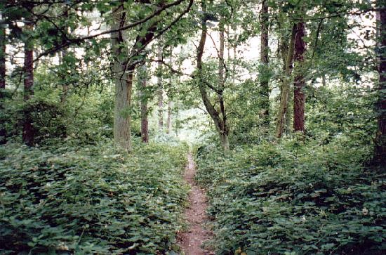
There is no more beautiful amenity in the area than Bourne Wood, 400 acres of forest that are open to the public at all times. It is full of secluded paths and tracks rarely used except by the animals that live here, including fallow deer that you will see if you are lucky because they are shy and reclusive. |
 |
NOTE: All of the features above are explored in greater detail - see the Main Index.
![]()
Go to: Main Index Villages Index